
Back in the day, I was enthused by the new highway and less so with the old road that seemed to pass through every town along the way and did little more than slow my progress getting from A to B; funny how hurried we are when younger.
Sydney - Melbourne Diversion
Getting off the highway and back on the adventure!
Words & Images: © Simon Bayliss
The Homogenous Highway
Over the last twenty years, I have travelled the Hume many times and with each trip, the old two-lane highway was slowly morphing into a four-lane dual carriageway.
Back in the day, I was enthused by the new highway and less so with the old road that seemed to pass through every town along the way and did little more than slow my progress getting from A to B; funny how hurried we are when younger.
I longed for the day when I could drive the entire route without these populated speed humps and in 2013, the last town bypass of the Hume was opened and now I could now drive unhindered.
But would I miss driving through the quaint little town of Holbrook and ponder why there was a rather large submarine in the main street despite the nearest ocean being 250km to the east?
The entire Melbourne to Sydney route is now a dual carriageway and the many towns along the have been replaced by several conveniently located service centres. No doubt, this is the most efficient way to drive a long distance, but undertaking such a trip often provides a feeling that an essential element is missing.
The highway has become a homogenous experience, as have the big service-centre multiplexes. Lacking any charm, character, or interaction; not to mention proper milkshakes or the iconic flattened ham and cheese 'toastie'. These highways of convenience are really just conduits from one metropolis to another and the ‘designated’ service centres are just mini-metropolises, without any town feeling or experience.
Maybe it is time to head off the highway and reconnect with what travel is really about and add a bit of adventure along the way.
So, with a few extra days to focus more on the journey than the destination, it is easy to leave the maddening highway and super service centres behind, focussing more on the experiences that lay beyond the bounds of the modern highway.
{accordion title="Head to the Hills" open="false"}
Head to the Hills!
With a love for rivers and a passion for mountains, there is a good option to turn the two hour Albury to Gundagai leg into a one-week adventure by heading east from Albury, following the Murray River up to Corryong, then driving up the Snowy’s to the highest inhabited town in Australia, over to the Snowy Mountains Highway, north to Blowering Dam, onto Tumut, and back on the highway at Gundagai.
** The route up the mountains (Swampy Plains Creek Road) is closed in winter, but the alternate Snowy Valleys Way along Tooma Road via Tumbarumba and Batlow is also wonderful.
Swampy Plains Creek Road
The road is good but does have some steep, windy and narrow sections, so some caution for larger caravans is essential. Like always, drive to the conditions and the effort will be well rewarded with some spectacular scenery and some great free-camping and picnic spots.
{accordion title="Exit, Stage Right"}
Exit, Stage Right
The departure point from the Hume is Albury, one half of the Albury-Wodonga border town that really identifies itself as one town since the 2007 bypass lessened the great divide of the river Murray.
Being an RV friendly town, Albury offers free RV parking right in the heart of town for up to 48 hours at the SS&A club (self-contained and no pets) or alternatively at the showgrounds a few kilometres out of the CBD (full facilities and pets allowed).
Probably the best option for extending the stay to further explore the region is at the Lake Hume Tourist Park about 15 km east of town. It is also on the planned route up the Murray.
{accordion title="Two Rivers, One Dam"}
Two Rivers, One Dam, and a Scheme:
As early as the 1860s, landholders of the Riverina had discussed flood mitigation options but it wasn’t until the early 1900s that work began on a solution to better manage the seasonal flows of the Murray and Mitta Mitta rivers.
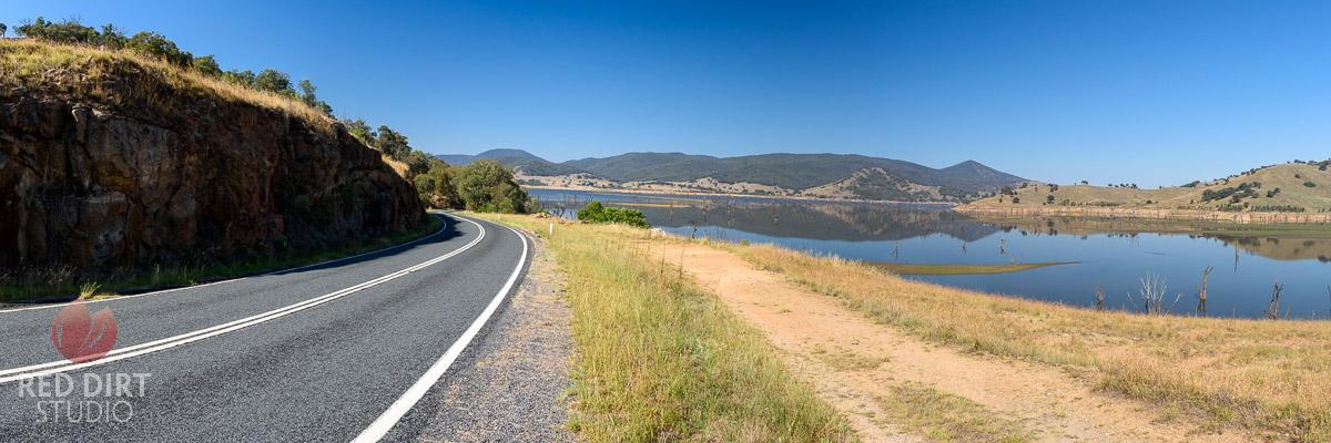
In 1919, work started on damming the Upper Murray River just downstream from its junction with the Mitta Mitta. The Hume dam, completed in 1936, was the biggest in the southern hemisphere at the time and the resultant reservoir retained water extending 40 km upstream from the dam and covered 20,000+ hectares.
Originally designed to hold 1,500 Gigalitres, Lake Hume’s capacity was doubled in the late 1950s to capitalise on the increased flow that resulted from the Snowy Hydro Scheme; the increase was primarily due to the tunnelled diversion of the Snowy River to the western side of the Great Dividing Range.
Lake Hume, which was named in honour of the explorer Hamilton Hume, is currently at around 40% capacity and while it may look good, it is considered low... but a lot better than the <10% of a few years back.
{accordion title="Let the Adventure Begin"!}
Let the Adventure Begin!
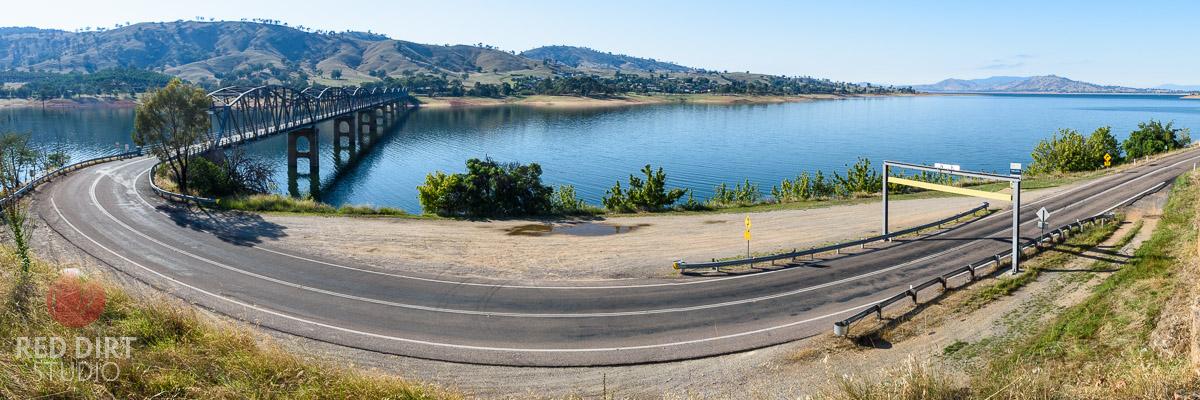
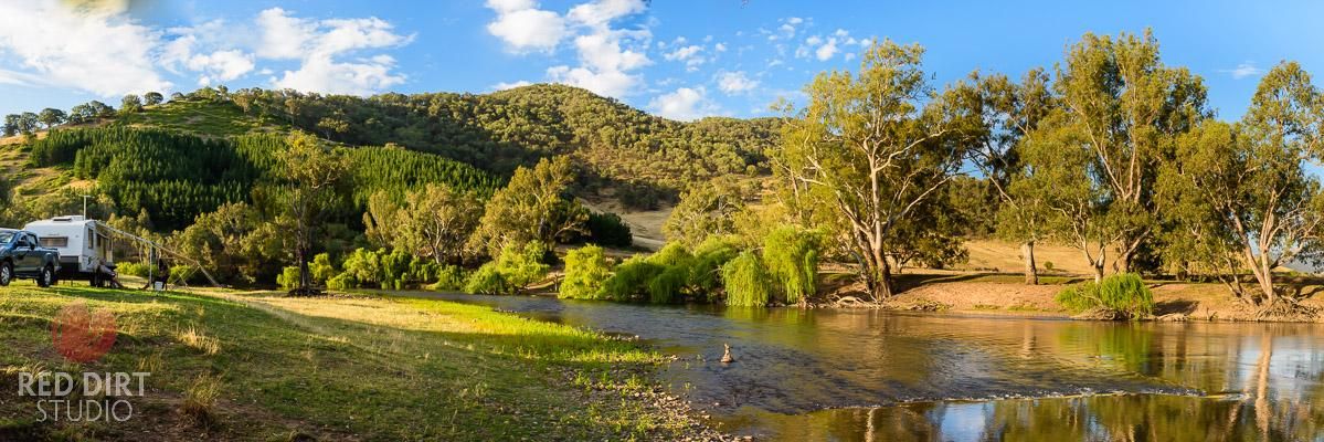
The first leg of this adventure begins by crossing the Bethanga Bridge, a 752 metres steel span bridge completed in the 1930s, over Lake Hume and continuing along the Murray River Road; initially by the eastern side of Lake Hume then tracking the southern bank of the Murray River for 88 km to the first free-camp, Gadds Bend Reserve, a few kilometres downstream from Walwa. (Both Walwa also offers caravan park accommodation).
Gadd’s Reserve is a great place to relax for a day or so and is within easy reach of both Jingellic and Walwa for some daytime activities.
Rested up and with the mountain air instilling the spirit of adventure, the next leg, only about 45km, continues along the Murray River Road via Tintaldra and onto Towong for some more free-camping just across the river into NSW at Towong Reserve Campground. This makes a great base for Towong as well as the larger and iconic town of Corryong.
Corryong, population 1,200, is the main centre of the Towong Shire and is where Jack Riley, The Man from Snowy River in Banjo Paterson's immortal poem, was born and is his final resting place. (It is generally accepted that the ‘Man’ in the poem was also inspired by a few others from the region including Owen Cummins and Charlie McKechnie.
accordion title="Heading on Up"}
Heading on Up.
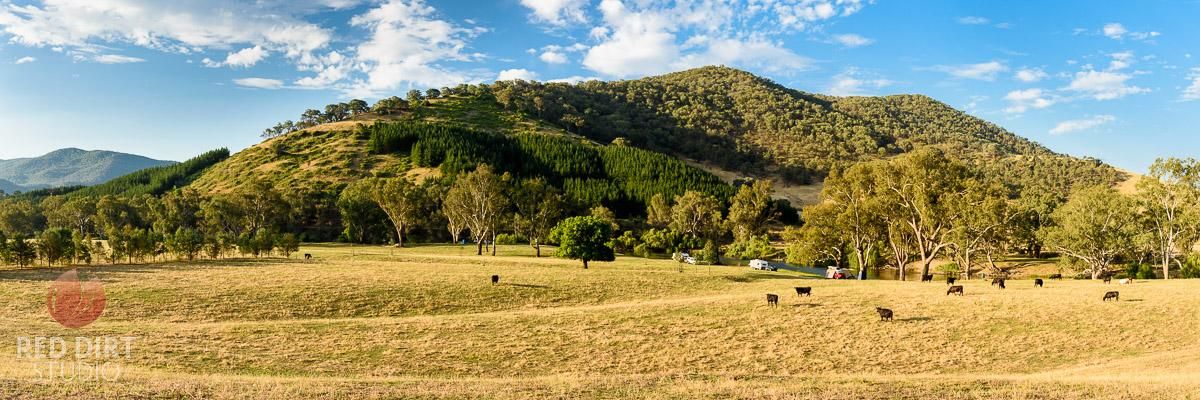
Leaving Towong, or Corryong, the route joins the Alpine Way for 15km before turning on to Swampy Plains Creek Road (set trip meter to 0) and climbs through every changing sub-alpine and alpine flora for a truly majestic experience. The road winds its way up with a few blind corners so slow and steady in sections is the way to go.
At about the 57km mark, be sure to stop at Bradleys/O'Briens Hut for a bit of a break to take in the alpine air and a step back in time by experiencing a traditional high-country hut.
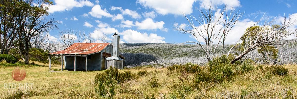
Bradleys/O’Briens Hut, 1,550m, was built in 1952 by Jack Bailey before the road was developed and was originally used for grazing - the other facilities like stables and yards were removed some time ago but it is easy to imagine living up here 60+ years ago.
Nowadays, during the warmer months, it is a set-off point for those exploring the Jagungal wilderness area, while in winter it provides a safe and warm refuge for cross-country skiers.
Like many other huts in the High Country, it is built of timber frames, corrugated walls and a roof with a swan timber floor and a concrete-based stone fireplace.
{accordion title="Up and Over"}
Up and over:
From Bradleys/O’Briens Hut, the route climbs for a few kilometres more before descending down Tumut Pond Reservoir and across the 86m high dam wall before again ascending for a spectacular view of the dam and surrounding alpine landscape.
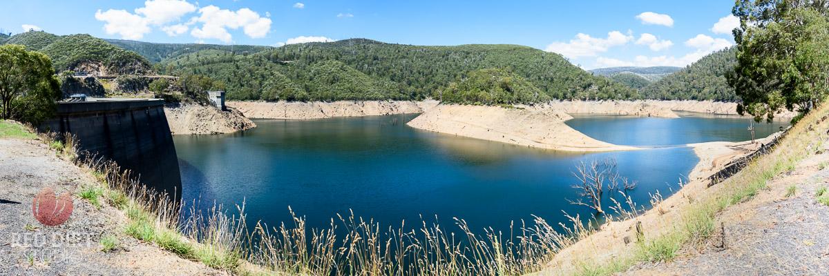
The Tumut Pondage covers 202.7 hectares at capacity and water from it flows to the underground Tumut 1 power station. The water that flows over the spillway continues on down the Tumut River into the Talbingo Reservoir and onto Blowering Reservoir, further along the route to Tumut.
About 8km further from the Tumut Pondage is Cabramurra, the highest inhabited town in Australia at 1,488m above sea level.
Established for use during the construction of the Snowy Mountains Hydro-Electric scheme in 1954, Cabramurra was built using prefabricated houses trucked in, but in 1974 the town was relocated to its current, less-exposed, location; the original site of the town is where the current lookout is. The town has no private housing with only those working for the Snowy Mountains Hydro-Electric Authority, and their families, living there.
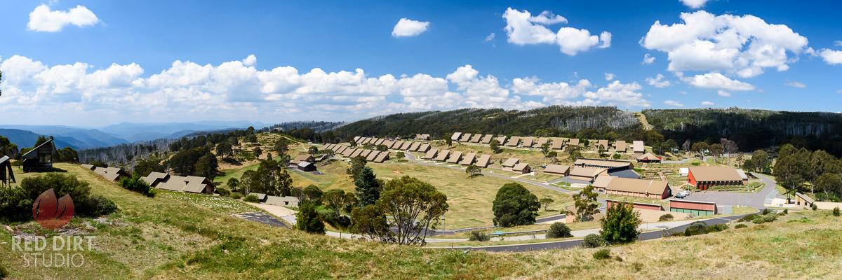
Another unique feature of Cabramurra is that its ski run was the first in Australia to be illuminated to allow night skiing.
It is a unique place and a great place to get a glimpse of life in the high country, learn about the Snowy Hydro Scheme and even grab a meal at the cafe/bistro.
{accordion title="Three Mile Dam"}
Three Mile Dam and Kiandra
The camp for the night is about 15km along Goat Ridge Road which joins Link Road and onto Three Mile Dam.
Three Mile Dam offers free camping, no fee, with facilities including toilets, barbeques and picnic areas. The dam was originally built to provide sluicing water for nearby diggings at Kiandra. Camp areas are unmarked and provide a unique opportunity to stay in sub-alpine woodland, surrounded by Snow Gums.
While camping, be sure to unhitch and visit the historic Kiandra heritage precinct just 7km away at the junction with the Snowy Mountains Highway. Kiandra is unique in three ways, it was Australia's only snowbound gold mining village, was the site of the shortest goldrush (1860), and was where Australian skiing began.
Back on the Snowy Mountains Highway, it is about 30km to Yarrangobilly Village, a wonderful free camping area on the Yarrangobilly River and a great place to base yourself while exploring the Yarrangobilly Caves. Note: The road into Yarrangobilly Caves is not suitable for caravans so basing at Yarrangobilly Village is recommended.
Yarrangobilly Caves is regarded as one of the most beautiful limestone karst systems in Australia and is an experience for all ages. Karst refers to the dissolution of soluble rocks such as limestone to form underground caves and drainage systems. Well worth a visit.
{accordion title="The Need for Speed"}
The Need for Speed
With the caves done, it is time to head down to Blowering Reservoir, the destination for the water of the Snowy Hydro scheme on this end of the Snowys; firstly, into Talbingo Reservoir, then Jounama Pondage and finally into Blowering Reservoir. From Blowering dam it continues on to join the Murrumbidgee near Gundagai.
Blowering Reservoir was the site for the world water speed record attempts during the late 1970s by Ken Warby. In November 1977, Warby set the world water speed record of 464.46 km/h (288.60 mph), which bettered the record by 3 mph held by Lee Taylor by a little over 3 mph. Another run was clocked at 317.60 mph, and Warby became the first and only person to exceed 300 mph on water and live to tell the tale.
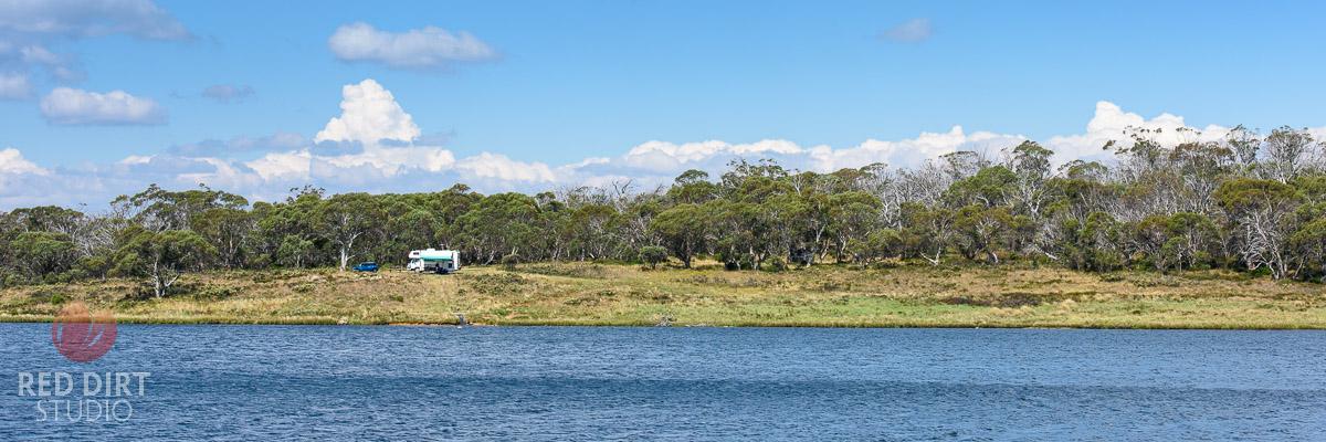
Blowering Reservoir is a bit quieter nowadays, although still a mecca for water sports, and its shores have some magnificent, easily accessible, free camping at the water's edge; Humes Crossing or The Pines which are about 20km out of Tumut and make a great base for exploring Tumut as well as Adelong and Batlow which is 30km south of Tumut on the western side of Blowering Reservoir.
Nothing Missed, Everything Gained:
Back on the highway, the sense of fulfilment for getting off the highway and into the wonderful country beyond the confines of the highway is the reward.
It reminds us that this is how travel used to be, and by choosing the quickest route we sometimes miss out on the best experiences, after all, it is more about the journey than the destination.
Winter Options:
As Swampy Plains Creek Road is closed in winter, the alternate route via Tooma, Tumbarumba, and Batlow, will still provide the adventure through this wonderful region to experience the magical vistas of the northern Snow Mountains.